Spencer Dormer
A good geologist is one who is inherently observant and analytical, has strong attention to detail, and is an effective communicator.
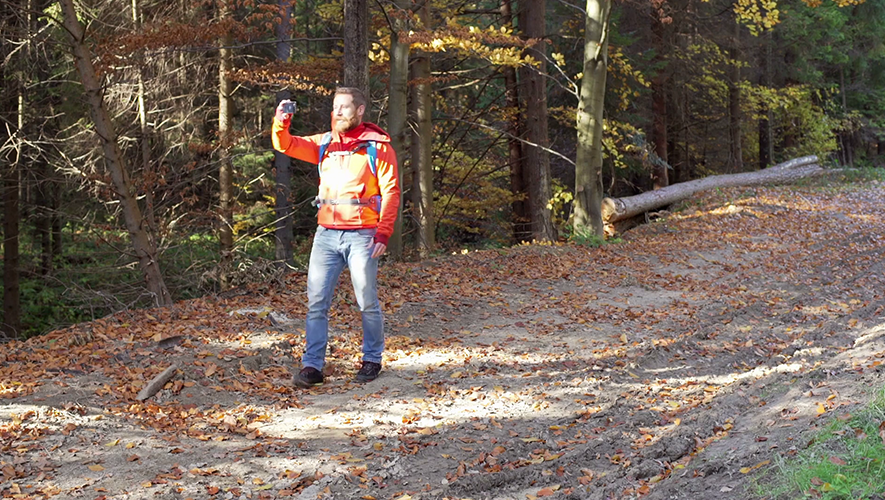
In this digital age of just about everything, a successful geologist should also have an aptitude for mobile technology.
Technology is not new to the discipline.
But in the last decade or two, artificial intelligence (AI) and machine learning have accelerated the evolution of deep technologies. Even your mobile phone can become a fieldwork tool, with the right app. (In some cases, internet connection is not even required!)
Mobile apps have definitely been a game-changer for fieldwork, and here are some of the top ones used (and recommended) by geologists themselves.
GENERAL GEOLOGY

Free on Google Play (with in-app purchase options)
Installs: 100K+
Rating: 4.1 (out of 1.1K+ reviews)
This is a basic app for any geologist, and even for those who are aspiring to be one. You can use this to identify fossils, minerals, and rocks.
Petrographic microscopes are used to identify rocks and minerals but it is not accessible and practical for everyone. This app is a great alternative because it covers the basic functions, plus it can work without an internet connection.

Free on Google Play (with in-app purchase options) and also on the App Store
Installs: 100K+
Rating: 4.0 (out of 2.3K+ reviews)
This is another entry-level, but nonetheless extremely useful, app for budding geologists or for professionals who are newer to the field. It has a mineral chart, including mineral classifications. It also has a geology dictionary, which is handy to have in your pocket especially if you’re doing fieldwork. You never know when you’ll need to look back at the basics!
FIELD MAPPING

Free on Google Play (but with in-app upgrade options) and also available on the App Store
Installs: 50K+
Rating: 4.3 (out of 589 reviews)
This app is a digital compass-clinometer. You can use this to capture and measure the orientation of planar and linear features in the field.
A clinometer can refer to any various instruments used for “measuring angles of slope, elevation, or inclination.” It is often combined with a compass (like the Brunton compass).
Unlike traditional hand-held bearing compass, this allows you to gather data faster and in larger amounts. The latter helps ensure that your data set is more statistically valid. You can also use it to capture and store both text and photos.

Free on Google Play and a Pro version available on the App Store
Installs: 10K+
Rating: 4.5 (out of 71 reviews)
This is a geological compass app that can be used by geologists, surveyors, and field or mining engineers to record strike and dip as well as trend and plunge.
A key feature allows you to view captured data in different kinds of visual output - map, stereonet form or tabular. You can also easily export data into spreadsheets.

Free on Google Play and also available on the App Store
Installs: 1K+
Rating: 3.8 (out of 36 reviews)
This app is from the same developers of FieldMove Clino. This one is primarily for mapping for captured geological data. It has drawing tools so you can create fault traces, boundaries, and other linework. It lets you show rock types by using simple polygons.
When you create linework, it is fully geo-referenced. This data is preserved when you export your project to other applications. You can export it in three formats: a CSV file, a .kmz (Google Earth) file, and or as a MOVE™ file if you are using the developer’s (Petex) software for model building and analysis.

Free at the App Store
Rating: 5.0 (out of 4 reviews)
This is another app that you can use as a geological compass. You can use this to measure the direction and angle of dip. You can add text notes to the measurements and plot them on a map. It is ideal for measuring the downside of geological planes because you can use this app both in display-up and -down positions.
This app is only available on iPhones or iPads.
PHOTOGRAPHY

Available on Google Play and on the App Store
Installs: 10K+
Rating: 4.0 (out of 641 reviews)
Building industry professional John Civijoski created this app for use in real estate, but it has evolved to become a favorite among geologists who need a GPS camera for fieldwork.
The built-in compass features capture altitude, compass direction, and GPS location, among others. It lets you view photo direction and location in map view, so you always know where a photo was taken and how to go back to that location.
It also works seamlessly with Google Earth.
NAVIGATION AND DATA COLLECTION

Available on Google Play with in-app purchase options
Installs: 10M+
Rating: 4.3 (out of 68K+ reviews)
You can use this app to check your altitude, your compass heading, daylight hours, and accurate UTC plus local time, among other data. It supports various satellites including GALILEO, BEIDOU, GPS, QZSS, SBAS, and GLONASS.

Free on Google Play with in-app purchase options and also available on the App Store
Installs: 1M+
Rating: 4.7 (out of 50K+ reviews)
This is essentially a map app which you can use offline. You can use it to track your location on any map. You can collect and record data, add photos, and even measure distance and area. You can purchase more maps in-app if you are after a specific one. And if you have a custom map created with GIS data, you can use it in this app.

GPX Viewer - Tracks, Routes & Waypoints
Available on Google Play and also on the App Store
Installs: 1M+
Rating: 4.5 (out of 34K+ reviews)
If you are after an app that lets you create detailed trip information like speed profile, air temperature, power, and even heart rate, this app comes highly recommended. It is a GPS locator and a GPS tracks viewer and analyzer. If you’re not out to do field work, you can also use it as a navigation tool for outdoor trips.
ROCK ANALYSIS

Free on Google Play with in-app purchase options and also available on the App Store
Installs: 50K+
Rating: 4.5 (out of 340 reviews)
As the name suggests, this geological app is for measuring rock outcrops and their orientation. You simply have to place it on the rock or plane in any orientation and it will measure dip and dip direction, as well as dip and strike.
You can also save other vital data like magnetic field information and GPS. It immediately attaches photos you take to the log when you send it via email from the app’s browser screen.
Based on reviews, the general consensus is that it is an invaluable tool for geologists on the field.
GEOLOGICAL DATA CAPTURE, MEASUREMENT, AND ANALYSIS

Free on Google Play
Installs: 100,000+
Rating: 4.6 (out of 4,200+ reviews)
QGIS is a “user-friendly open source geographic information system (GIS).” QField was built on top of this so users can create maps and forms using QGIS and use those on the field.
Some users have cited its user-friendly interface and availability of multiple options for data collection.

Free on Google Play with in-app purchase options and also available on the App Store
Installs: 10,000+
Rating: 4.5 (out of 93 reviews)
This is an extension of the aforementioned QGIS software. This app addresses the downsides of manual note taking on the field as well as manual transcribing of GPS notes and georeferencing. You can create mobile forms which your survey teams can complete while on-the-go.

Free on Google Play and also available on the App Store
Installs: 500,000+
Rating: 3.4 (out of 1,000+ reviews)
This app is ideal if you do a lot of surveys. It creates smart forms and provides support for multiple languages. It even works offline.
You can easily collect, analyze, and upload data, and this, in turn, helps guide data-based decisions, wherever you are.

Free on Google Play and also available on the App Store
Installs: 100,000+
Rating: 3.5 (out of 276 reviews)
This data collection app helps bridge the gap for field workers who have to deal with large volumes of data. It can be used to capture and edit data using map-driven forms. Acceptable types of data include videos, photos, and audio recordings. ArcGIS Collector works offline.

Free on Google Play
Installs: 1,000+
Rating: 4.2 (out of 5 reviews)
Geologists use this app to collect data using different kinds of base maps, including but not limited to cross-sections and sketches. It uses tags for conceptual data grouping and areas of observation for spatial data grouping.
StraboSpot is a result of a project funded under the US National Science Foundation (NSF) Geoinformatics grant. It was built to address a lack of available structural geology and tectonics (SG&T), which is the “most basic dataset about the solid Earth.”

Free on the App Store
Rating: 5.0 (out of 2 reviews)
Structural geologist and Cornell University Professor Emeritus Rick Allmendinger developed this app which is designed to assist with collection, visualization, and analysis of fault slip data while out on the field.
You can use the app to do basic calculations of lines and planes as well as to plot fault plane solutions and different types of axes.

Available on the App Store
Rating: 4.3 (out of 3 reviews)
This app is a professional tool for the measurement and analysis of geological structures. It is a digital clinometer with features for stereographic projection and instability analysis. It also has wireless data sharing and instant analysis report generation capabilities.
Have you used any of these apps? What do you think? And what apps do you personally recommend?
We’ll update this post with your recommendations so keep them coming!
***
